Microsoft Flight Simulator 2020 requires you to follow an authentic flight plan, and that means knowing which runway you’re supposed to land on. When you approach the airport you intend to land on; you’ll be given approach and landing instructions. However, if you’re just starting to play Flight Simulator 2020, you likely have no clue how to follow these orders.
We’ll tell you how to find the correct runway to land on in Flight Simulator 2020 below. We’ll cover how to use airport diagrams and how to use a compass and heading to ensure you’re touching down in the right place.
How do I find the correct runway to land on in Microsoft Flight Simulator 2020?
The first step to finding the correct runway to land on starts before you even take to the air. In real life, pilots are expected to know their flight plans by heart, including the airport diagrams for the fields they’re taking off and landing at.
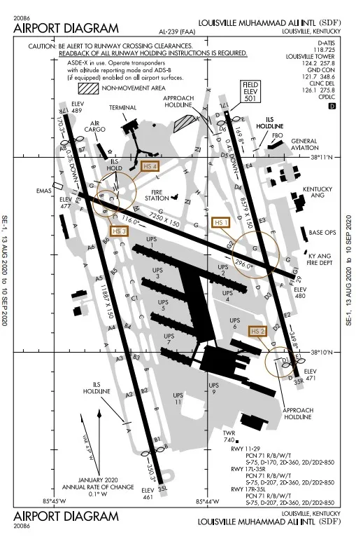
In Flight Simulator 2020, you’ll need to choose a departure and arrival point before you take to the skies. Before you take-off, find your destination airport on SkyVector and take a look at its diagram.
Use airport diagram to find the runway
I’ll be using Louisville Muhammad Ali International (SDF) as an example, but all diagrams are read similarly. Looking at the layout, the top of the page is north, the left is west, right is east, and bottom is south. Each diagram will present the airport in this manner.
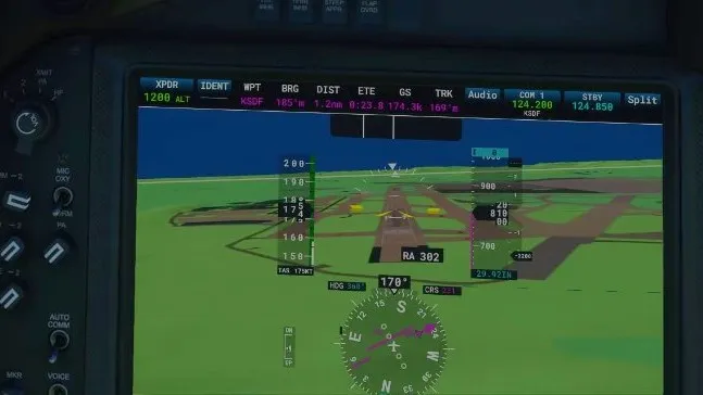
Depending on the aircraft you’re flying, you may have GPS and other avionics to assist in pathfinding and landing. However, some only have a compass to use. For this guide, we’ll assume you’re flying using Visual Flight Rules (VFR) and using only your vision and compass for approach and landing.
When approaching your destination airport, you’ll need to radio the tower and request approach instructions. An example response would be:
Louisville Tower: (Aircraft Callsign), Louisville Tower, Fly left downwind runway 35L. Altimeter 29.92 Wind 275 at 3.
This tells you the runway you’ll be landing at: 35L.
Reference the airport diagram, and you’ll see that in simple terms, 35L is the westernmost runway if you approach from the south. A helpful tip to remember is that runways are named based on their heading. Knowing this, you can easily deduce that runway 35L is the left-most runway at SDF that follows a heading of 350 degrees.
The tough part comes in when you realize that almost every runway actually has two designations. Airplanes take off and land against the wind. Which runways are used depends on which way the wind is blowing. So, the western-most runway at SDF is used as 35L when the wind is blowing north-to-south, and planes take off and land south-to-north. However, when the wind is blowing south-to-north, the western-most runway is used as 17R (following a 170 degree heading), and planes take off and land north-to-south.
Find runway by designation and compass heading
It can be confusing to identify runways at first. However, if you know the number, you don’t even need the airport diagram. Just take the runway number and add a zero to the end. You can then use the heading on your compass to deduce the direction of the runway and the R(ight), C(enter), or L(eft) designators if there are multiple pointing in the same direction.
There are exceptions to this. Larger airports may have runway designations that don’t follow this rule completely. So, if you’re unfamiliar with an airport, you should have the diagram on hand to prevent confusion.
